Know the ground,
before the ground.
Official mapping, native on your Mac and your iPhone. Stack the layers from IGN, swisstopo, IGN España and the USGS, draw to the metre, measure the climb, export the GPX your field app will read. Not a web app in a tab.
Free, no account · Pro is a one-off purchase · 12.8 MB · v1.4.0
The map you already know, in the right place.
Plan IGN, aerial imagery, the slope map, BD Forêt, the cadastre. Layer identifiers are generated from the Géoplateforme's GetCapabilities, never typed by hand — when IGN moves a layer, the app knows before you do.
The reference map, down to 1:5,000 — continuously updated. Tiles served live by data.geopf.fr — drag the map.
The profile reads like a sentence.
Every point on the track carries its distance, its altitude and its gradient. Run the cursor across: the map follows, the stage names itself, and the effort becomes a number before it becomes a surprise.
A workbench, not a demo.
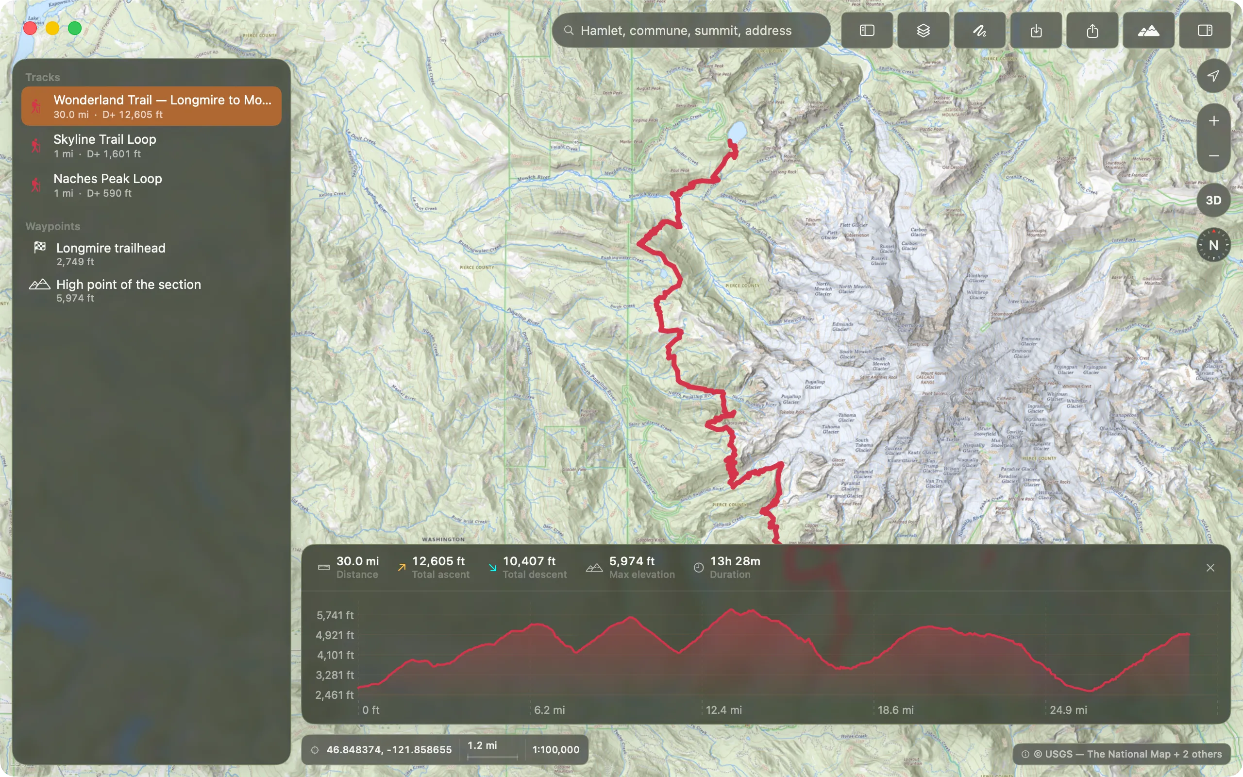
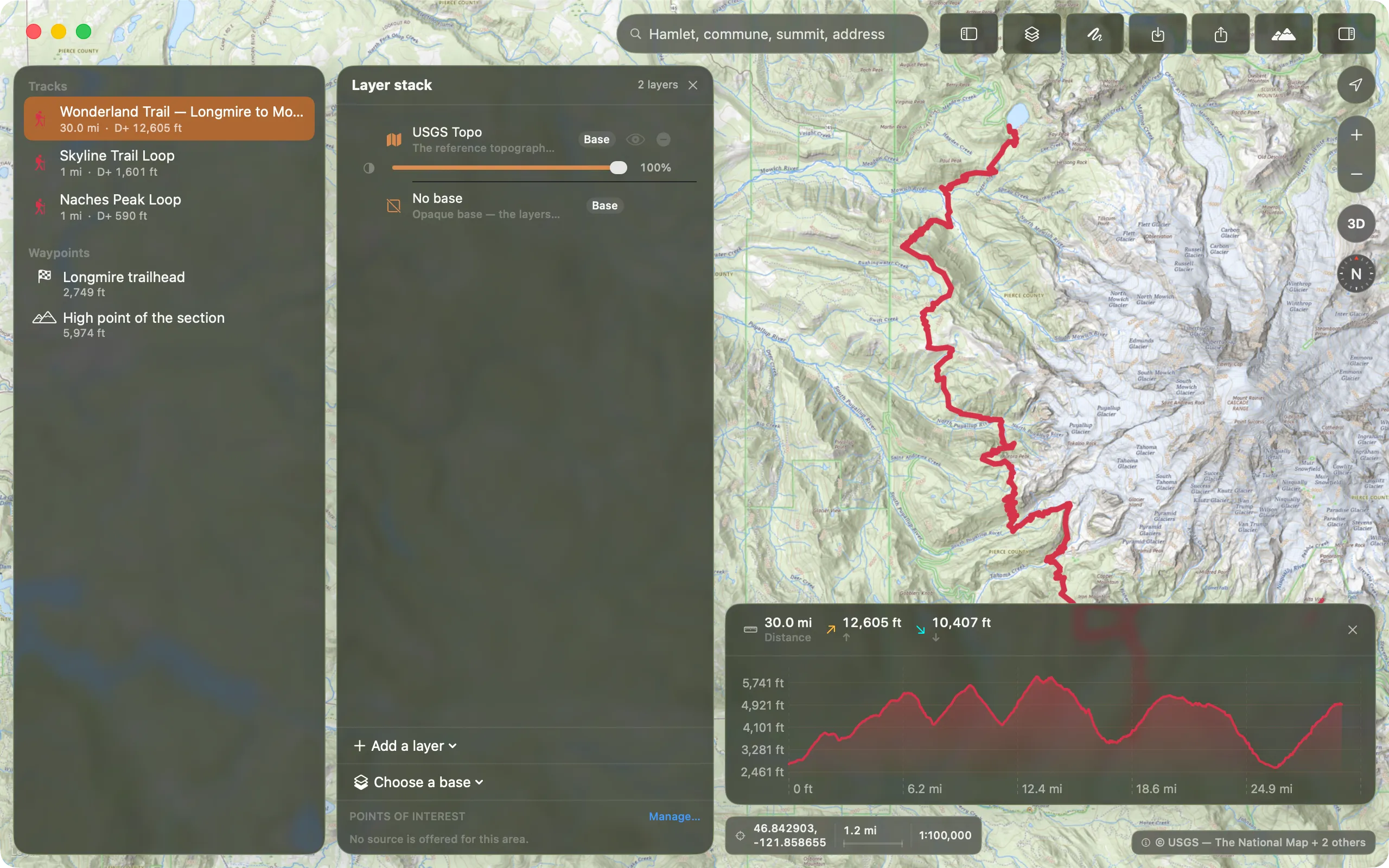
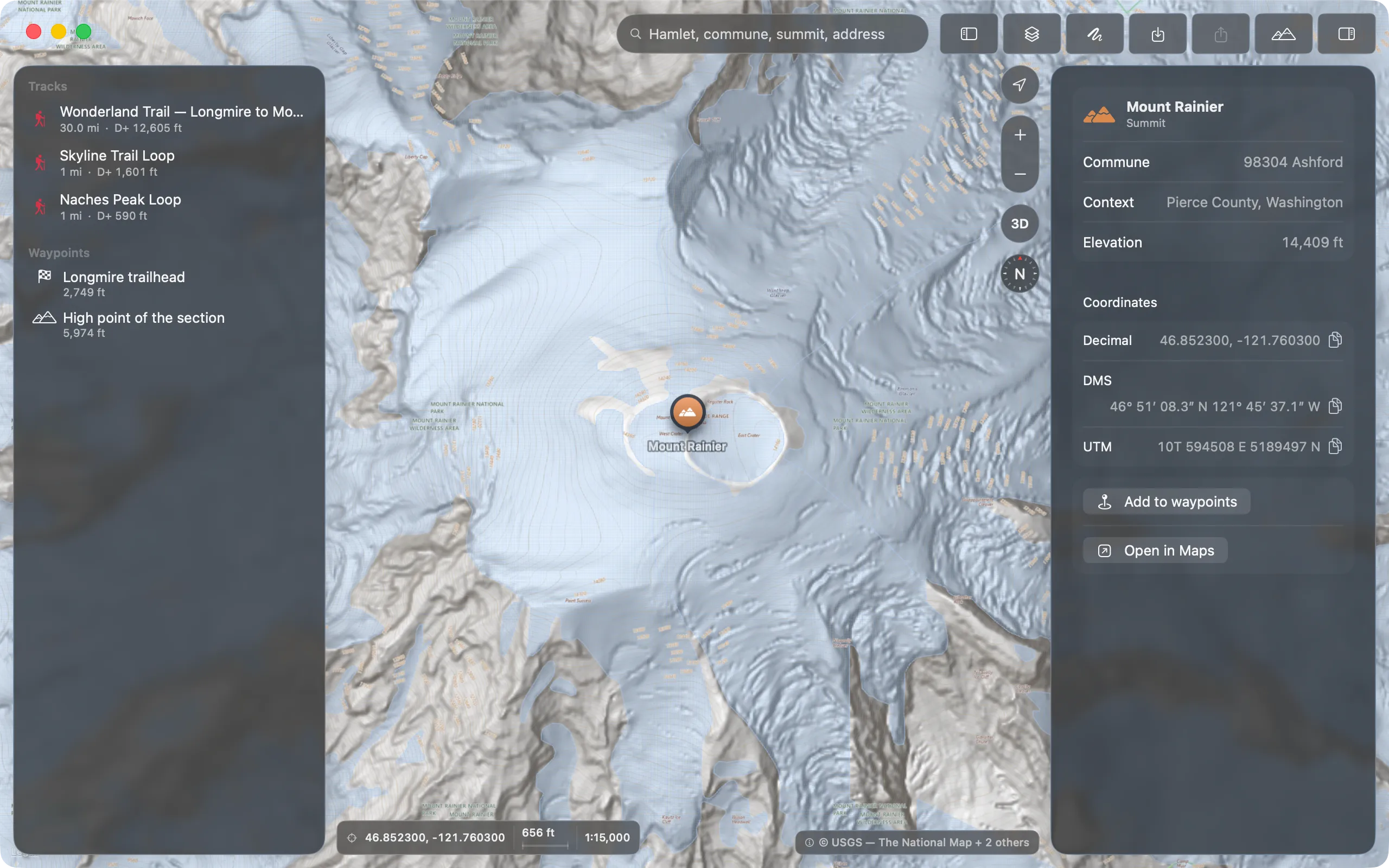
“I plan my routes on a Sunday evening, on a 27-inch screen, with fifteen tracks open. Doing that in a browser is working in mittens.”
What is around you. And who says so.
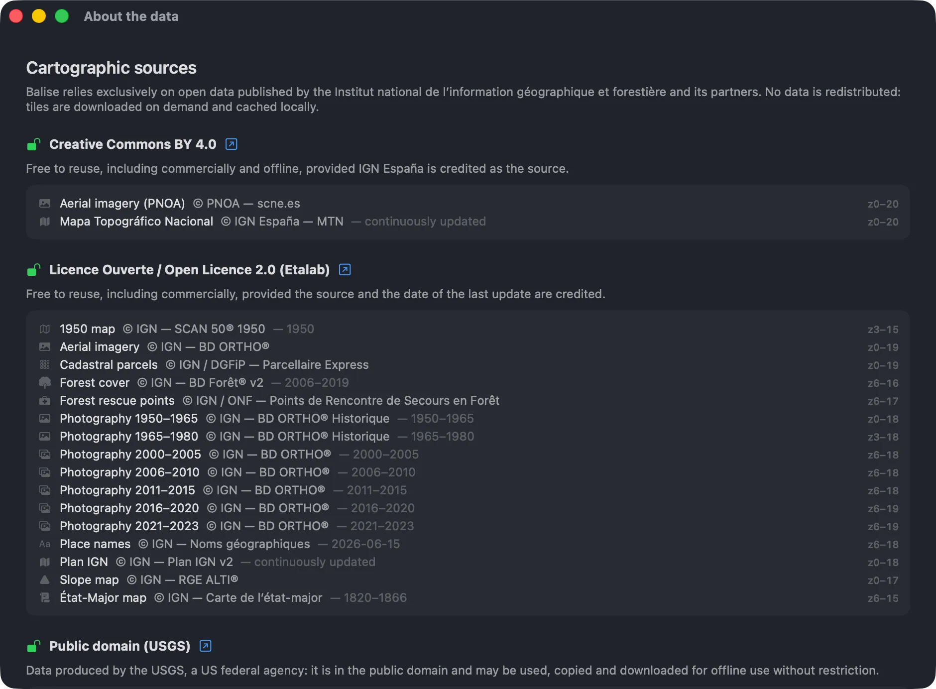
Three point sources, off by default, switched on from the map. Each one states who publishes it, under which licence, how many points it holds, and whether it works without a signal — because on a col that is the only one of those questions that matters.
The Licence Ouverte data is embedded in the application: it draws with no network at all. The refuges.info data is share-alike, so it is consulted and then forgotten, never copied into a cache.
No account. No telemetry. No server at all.
Balise talks only to map servers, to fetch the tiles you asked for. Your tracks and your exports live in your own folder, as .gpx, readable without the app. Between the Mac and the iPhone, your library travels through your own private iCloud, the one on your Apple Account, and never through a server of ours. That sync is part of Balise Pro from 1.1.0 on.
Hosts contacted: data.geopf.fr in France, basemap.nationalmap.gov and elevation.nationalmap.gov in the United States, www.refuges.info if you turn the mountain huts on. Sync, which is Pro, runs through CloudKit, at Apple. No API key, and no Balise server.
Pay once. The tool is yours.
No subscription, no tile quota, no watermark. The free version is a complete topographic application: the maps, the stacking, every export. Pro adds the features listed below, and nothing else.
All the topographic mapping, all your GPX files. No account, no watermark, no expiry date.
Drawing the route on the map, seeing what is around it, reading the cadastre, and finding your library on both your devices. The rest of the application is unchanged.
The point overlays and the cadastre are French. In the United States, Pro unlocks route drawing and library sync; snapping to the footpath network, the overlays and the cadastre have no federal equivalent and stay unavailable.
Download — Pro unlocks inside the appWhat follows is not built, is not included in the €9.90, and has no date. It is here to say where the application is going, not to be bought. If one of these ever becomes paid, it will be announced beforehand, not afterwards.
The questions, settled.
The ones that come up most. If yours is not here, write to us.
Where does the mapping come from?
From IGN's Géoplateforme, under the Licence Ouverte / Etalab 2.0: Plan IGN, aerial imagery, the slope map, BD Forêt, the cadastre and historical surveys, plus the geocoding and elevation services. No key, no middleman, and attribution shown in the app as a piece of interface rather than a footnote.
Which devices are supported?
macOS 26 and later on the Mac, iOS 26 and later on the iPhone. Balise is written in Swift and SwiftUI with no web layer inside: it launches in a second and pans at your display's refresh rate. The map is drawn by MapKit, not by a third-party SDK.
Why no SCAN 25 map?
Because its licence does not allow it yet. IGN's SCAN maps are free for professional and associative use, which is not the same thing as redistributable in a consumer application — and caching tiles offline is redistribution. The rest of the catalogue is under the Licence Ouverte and raises no such question. Until this is settled with IGN, the layer is not offered in the app.
Where are the GR trails?
On the map, without the waymarking. The physical path of a GR is part of IGN's BD TOPO under the Licence Ouverte: it draws as a footpath on Plan IGN, and Pro route drawing snaps to it. What Balise cannot supply is the white-and-red blazing and the GR®, GRP® and PR® designations — those are registered trademarks of the Fédération Française de la Randonnée Pédestre, and the itineraries themselves are not freely redistributable. To follow a specific GR, get the track from the people who publish them: the app's Routes menu fetches it from them and links to their page as well. It opens straight into Balise, which reads GPX, KML and KMZ. Those tracks are for personal use.
Does it work outside France?
In three other countries, yes. In Switzerland, five swisstopo layers — the Landeskarte down to 1:10,000, its grey edition, SWISSIMAGE, swissALTI3D relief shading and the official hiking network — with swissALTI3D elevation. In Spain, the Mapa Topográfico Nacional and PNOA orthophotography, with the MDT05 model. In the United States, five USGS layers and 3DEP elevation. The country is read from the region under the window rather than set by hand, and elevation follows each point: a track crossing a frontier takes its heights from the right side. What stays French: snapping a route, which relies on IGN's BD TOPO, and the two heritage registers. The mountain-hut overlay covers France, Switzerland and Spain. Elsewhere you still have Apple's basemap and your GPX files: the map draws, the terrain does not.
What about the phone, out on the trail?
Balise for iPhone is part of version 1.0, and it is the same application: the same official layers, the same route drawing, the same GPX. Your library follows through your private iCloud if you have Pro, which is bought once for both platforms. Two limits worth knowing before you set out: no turn-by-turn voice guidance, and no downloadable offline regions yet, so ground you have never looked at needs a connection. The GPX export stays standard and reads in Iphigénie, SityTrail, Garmin or Apple Maps.
Do my tracks go anywhere?
Not to us: no Balise server exists, so there is nowhere for them to arrive. The app talks only to map providers — data.geopf.fr in France, the USGS in the United States, refuges.info if you turn that overlay on — to ask for the tiles and elevations you asked for. One exception worth knowing: if you use both the Mac and the iPhone, your library syncs through the private iCloud database on your Apple Account. It therefore passes through Apple, never through us, and we have no way to read it. Your files stay as .gpx in your own folder, readable without the app.
A Windows or Linux version?
No. Balise is a native Apple application and will stay one: MapKit, SwiftUI, the system's windows and shortcuts. A cross-platform port would be a worse product, and one already exists in your browser.
Silhouette — clean cutouts, in batches.
Batch background removal for the Mac, with marketplace presets and real edge control.
Cadence — who said what, and when.
Native macOS transcription with speaker identification, on the Neural Engine, offline.
Know the ground, before the ground.
On Mac and iPhone.
Free forever: every map, every layer, GPX export. Route drawing and the point overlays unlock once and for all, for €9.90, on both platforms.